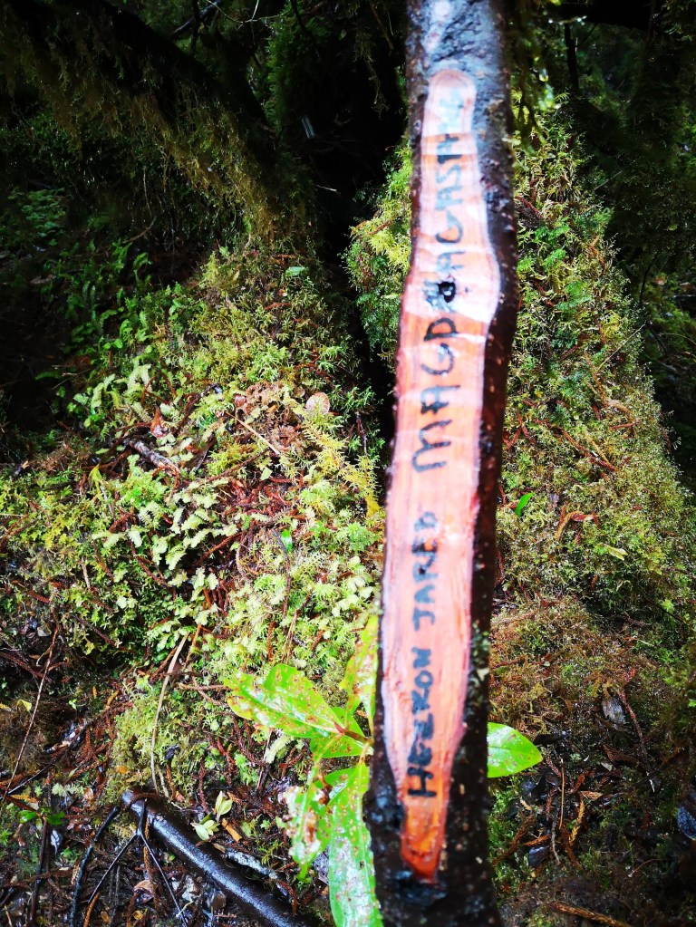
We had to pay 4k pesos each to climb Mt. Pandadagsaan or the White Peak. According to Ryan Belayo, an LGU employee, technical person, and one of the owners of the mountain which was declared an ancestral domain, the “white” in the White Peak comes from the mushrooms on the stones that reflect the sun’s light.
Ours was a special climb because we decided the date: October 30 to November 1. Otherwise, it could have been any ordinary climb.

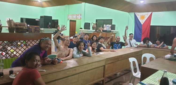
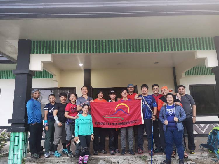
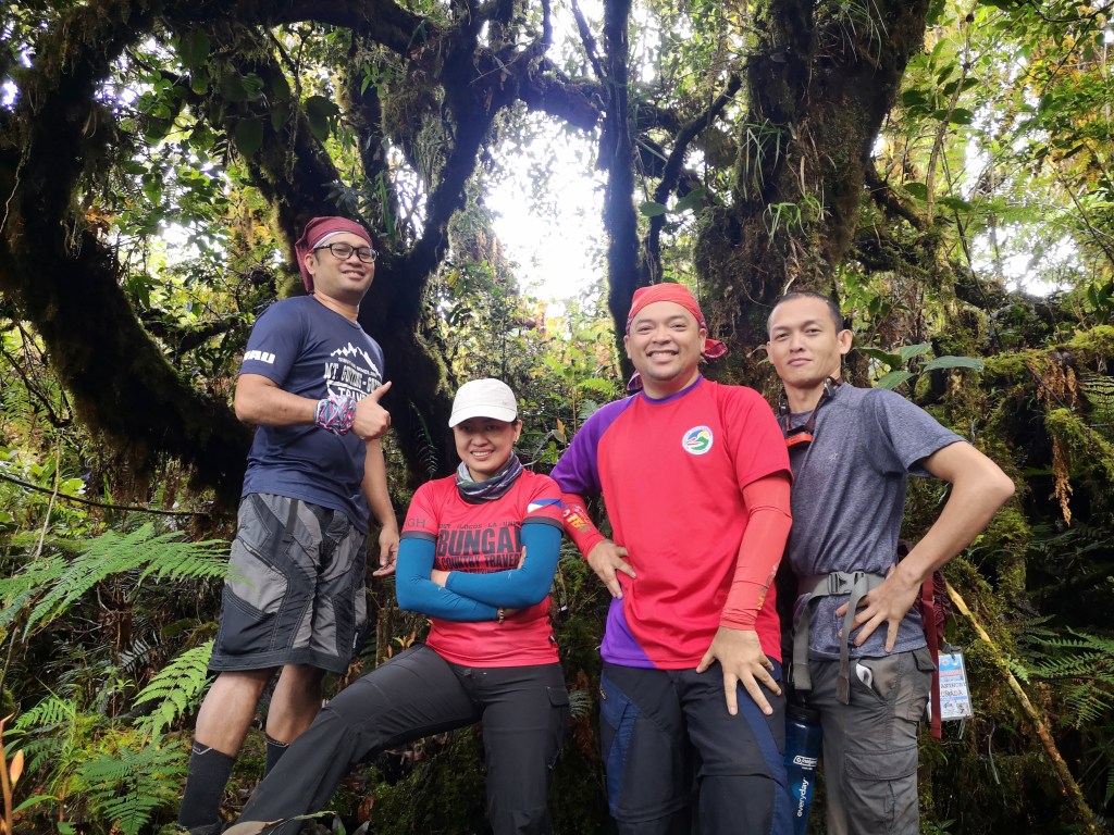
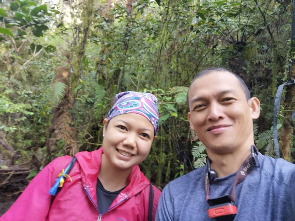
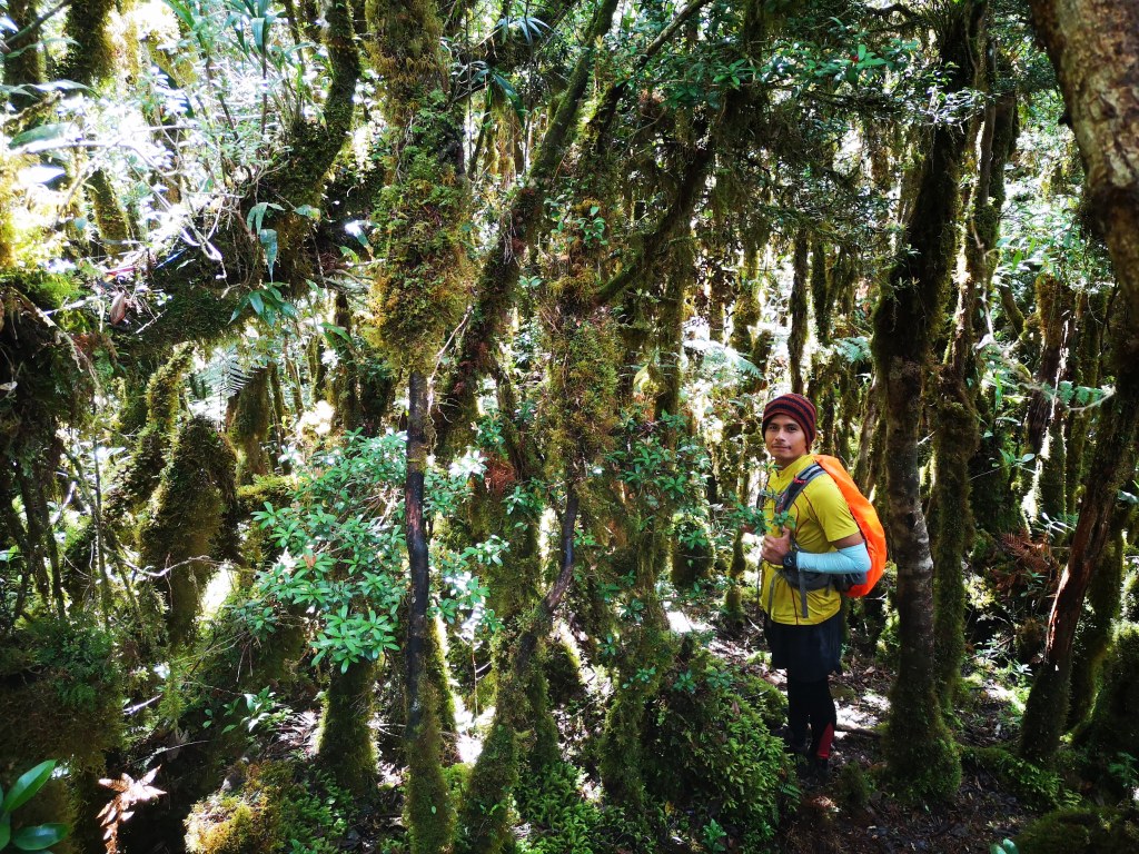
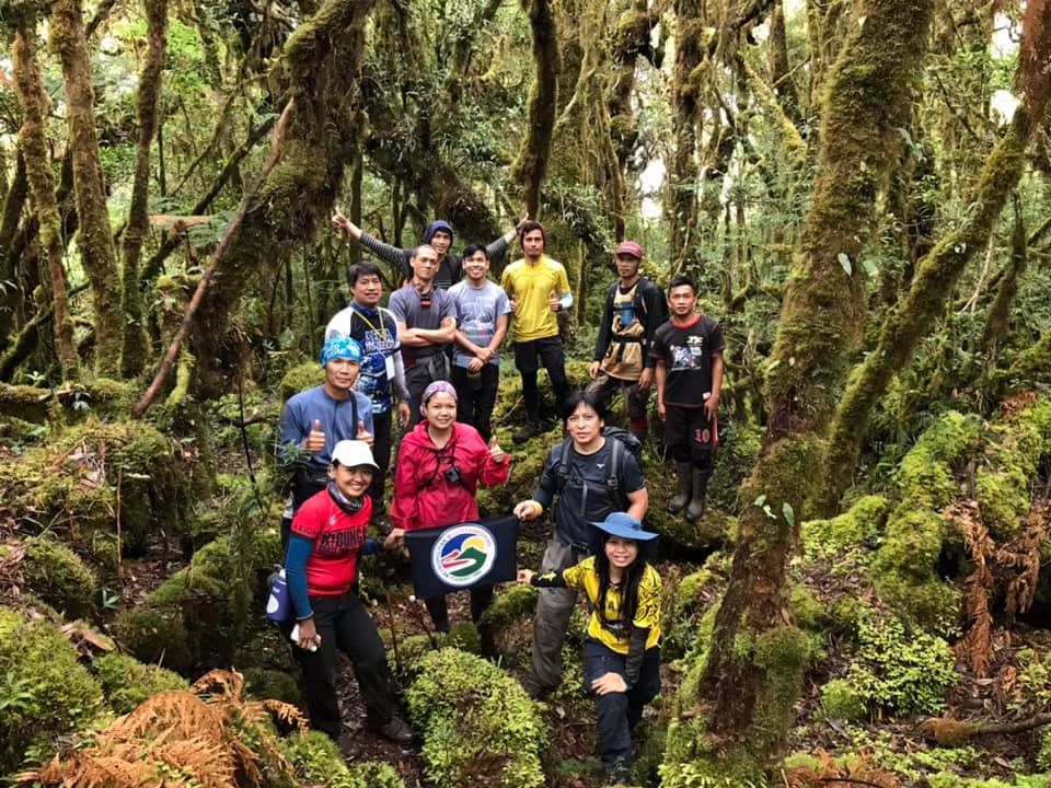
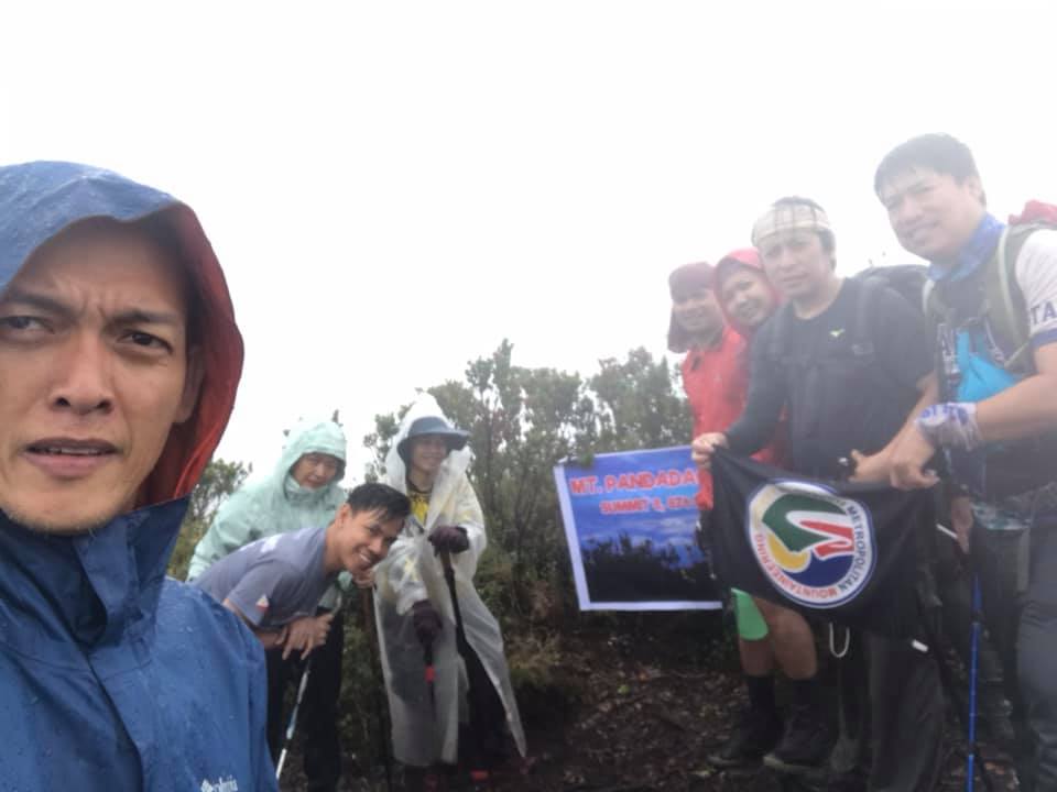
We were fifteen from the Metropolitan Mountaineering Society (MMS) organized by our founder Long Henson: Long himself, our outgoing president and vice president Roy Lopez and Maurice Mau Romarate, respectively, Maria Luisa Ledesma aka Dok Mai, Thomas Suarez aka Dok Thom, Dani Ponciano, my MMS Ninang Lea Tuazon, Antonia Tonie Vidola, Davao Native Stanley Quidato, my batchmate (2017) Karis Corpus, Zaldy Santos, RC Abeleda, Mary Glazel Biocarles and Jess Mar Pontillas.
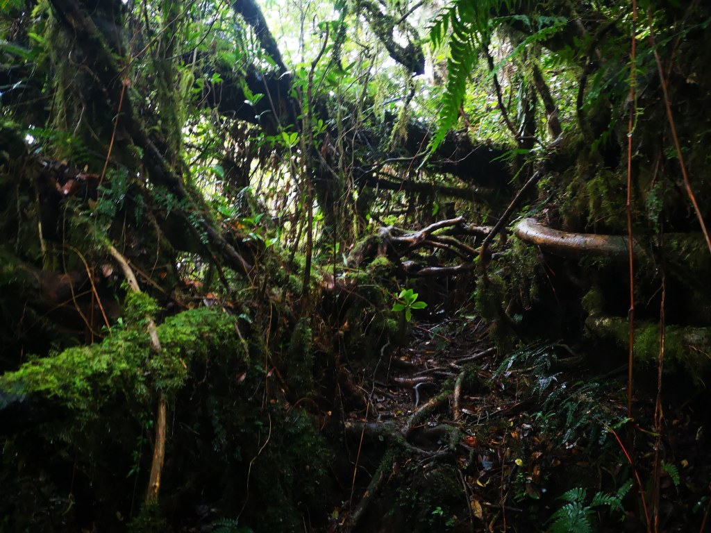
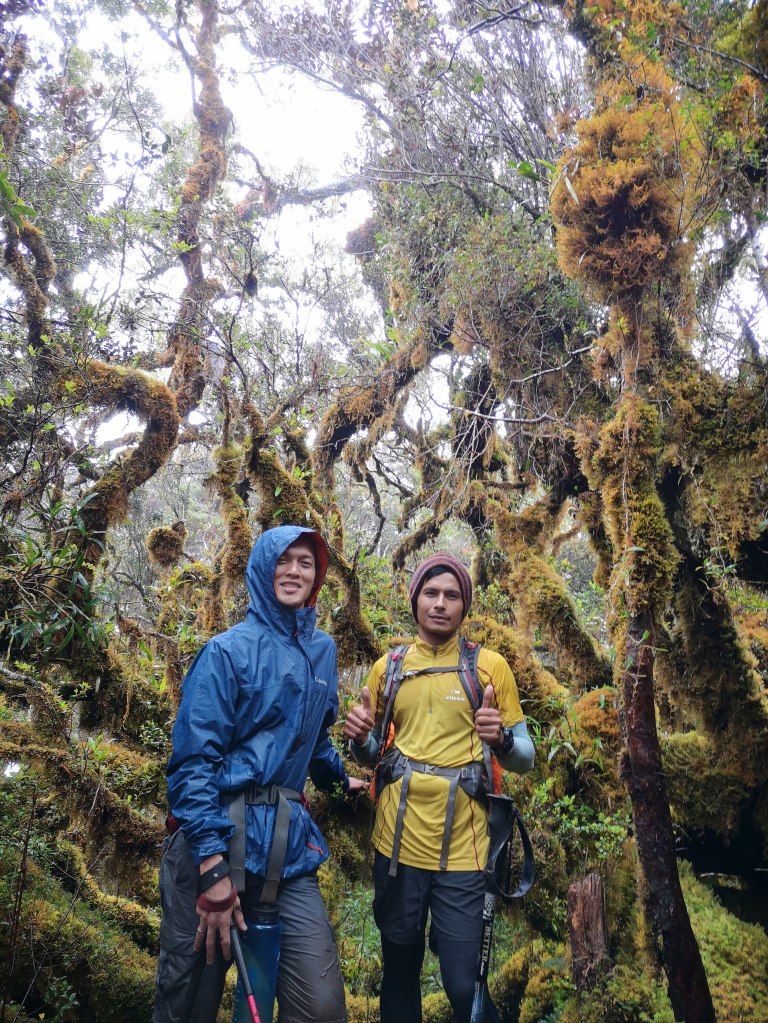
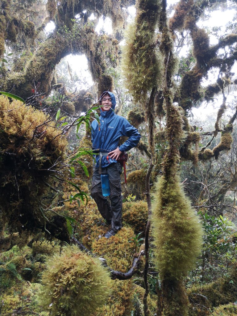
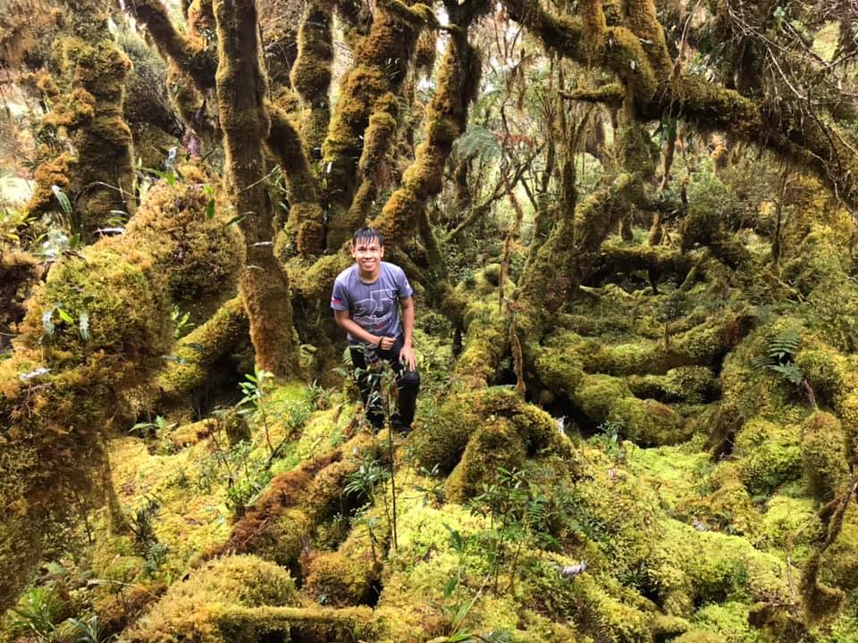
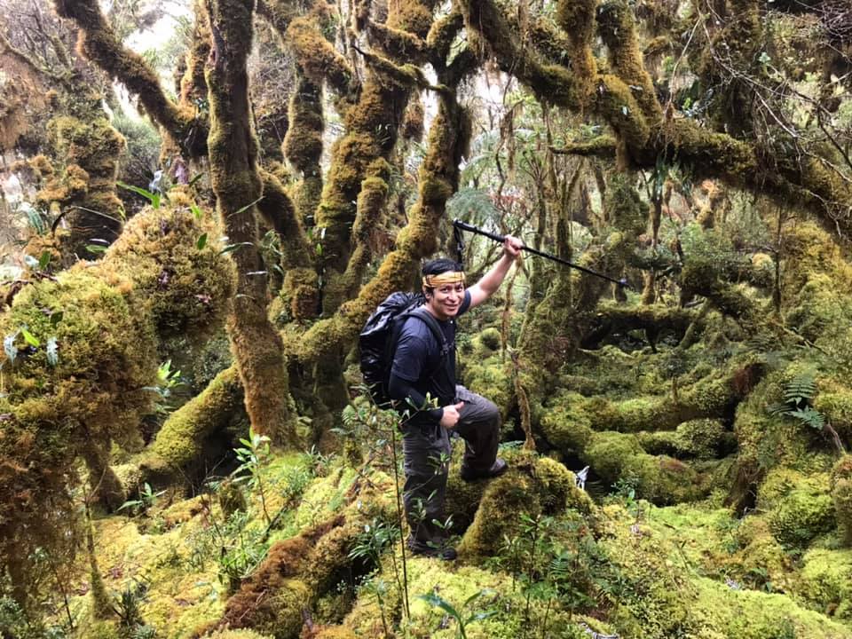
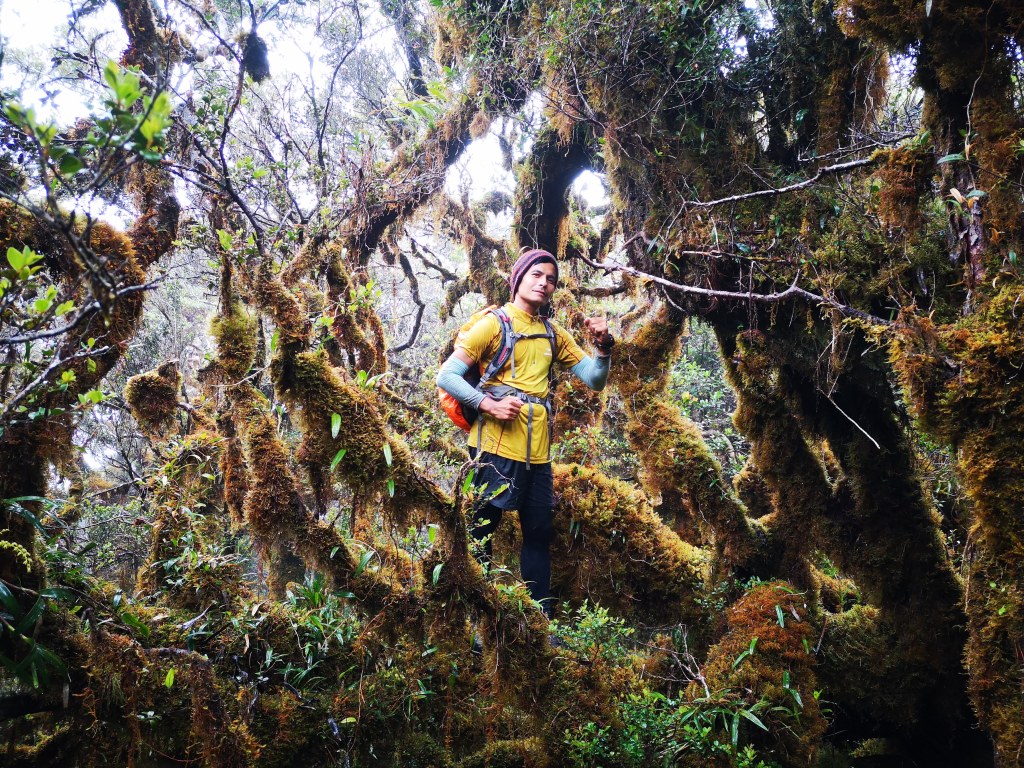
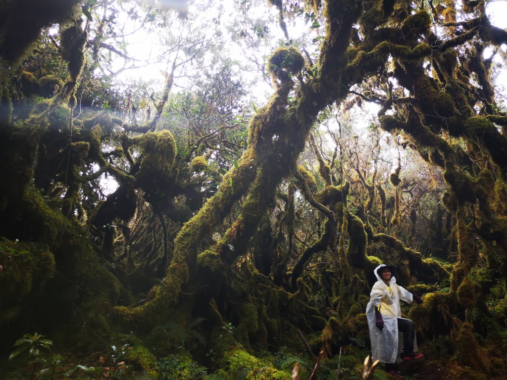
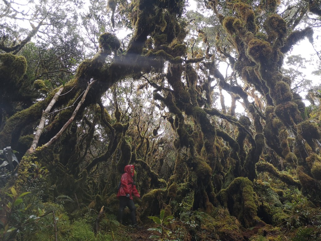
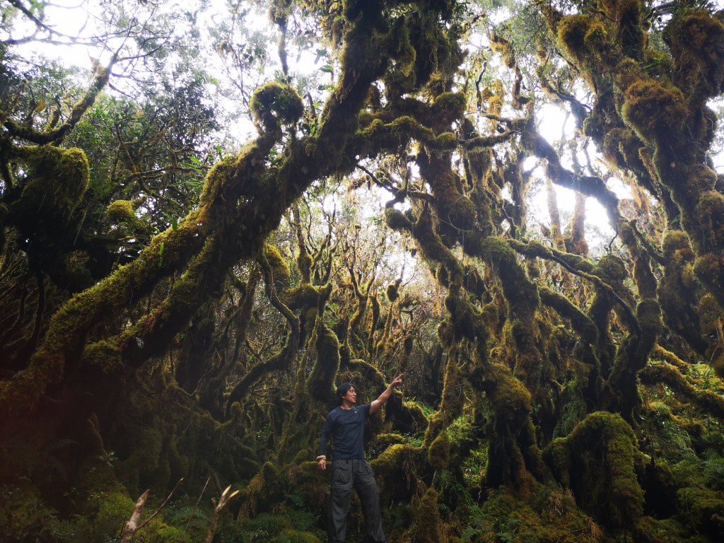
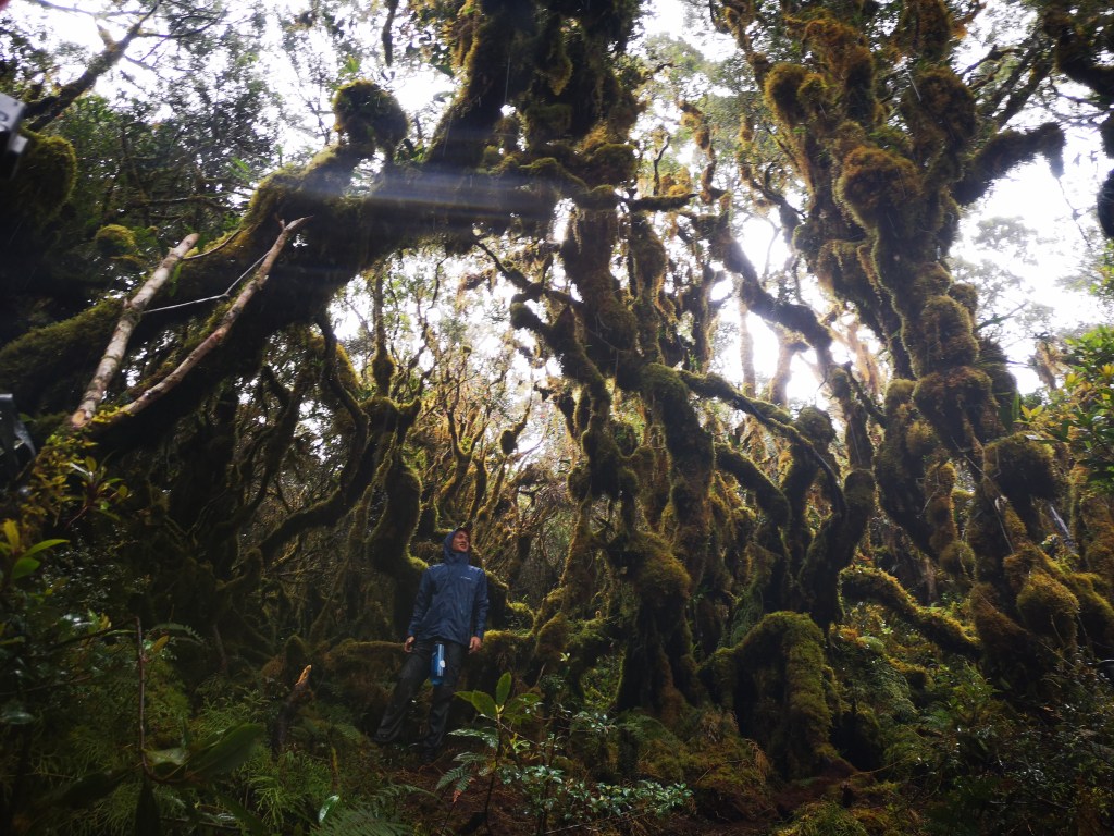
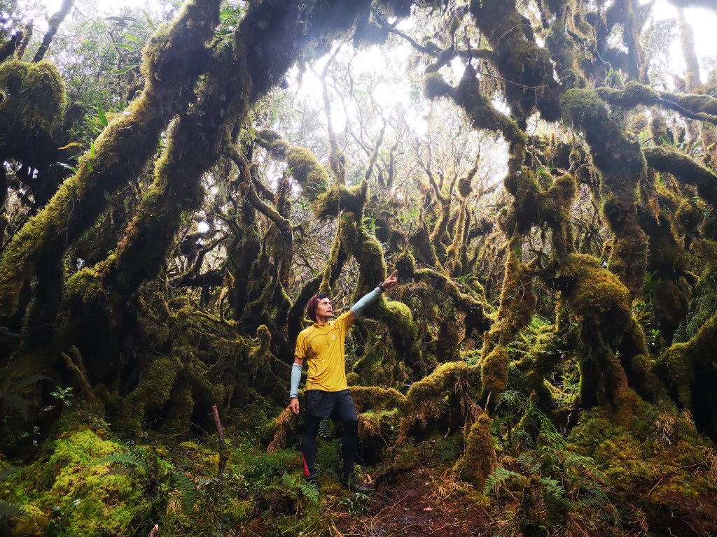
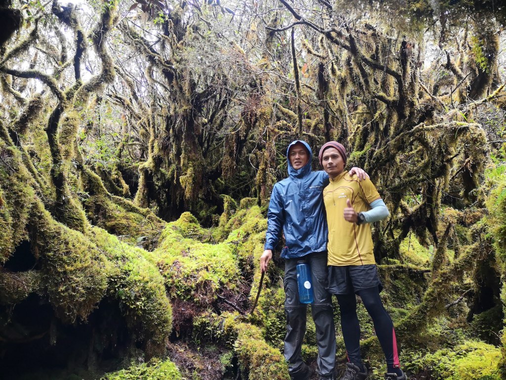
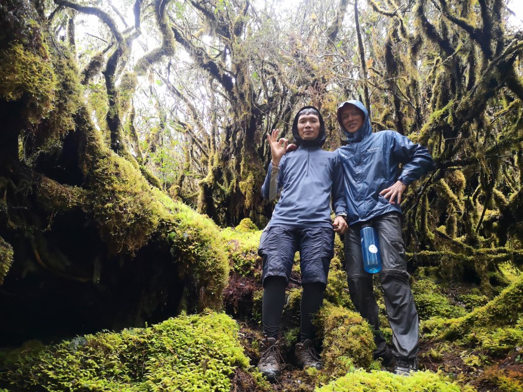
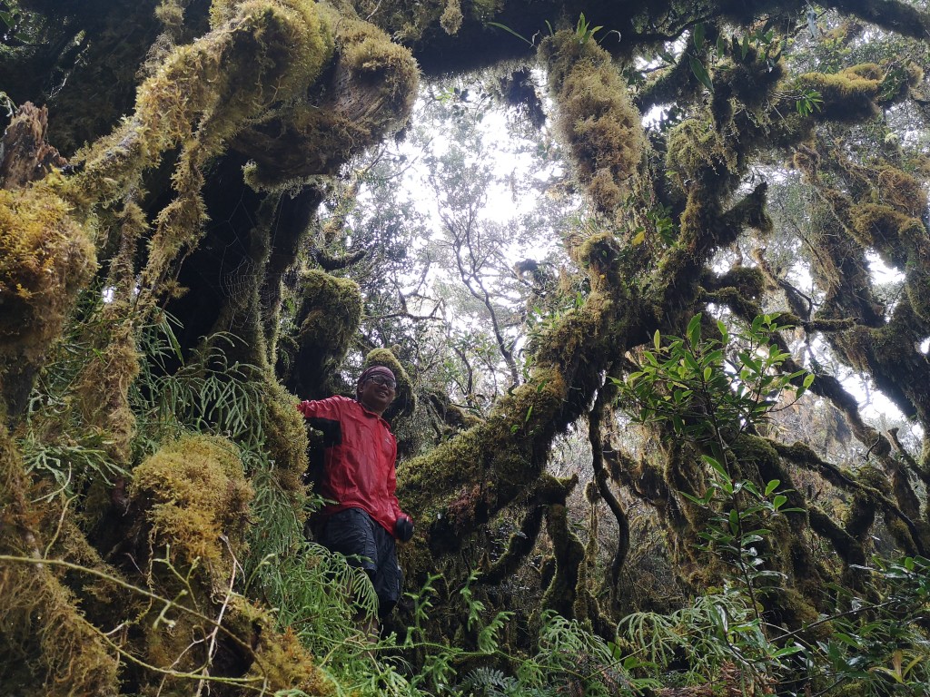
The White Peak is famous for its mossy forest. There’s even a portion after Peak 2 called Avatar Forest named after the title of the movie of James Cameron. This is the highlight of the climb and this is what people endure the very technical climb for: to be and have pictures in the Avatar forest.
According to a mountaineering website, the White Peak is rated 6/9. So, this should be easy. We had two preclimbs to submit our medical certificate, ID’s and payments. Since this was going to be a twin mountain hike, we also talked about our second mountain, the UNESCO World Heritage Site and Park, Mt. Hamiguitan. Since Long and Roy had been there when they joined a research team of our botanist member Sarah who was joined by her husband Joseph Zamudio, they know the mountain. It’s the White Peak that we have no idea about.
So, we all booked our ticket to Davao and on October 29, 2019, we flew.
The tribal house, our accommodation for the first night, has a large sala where a portion was partitioned for tables and chairs and the kitchen.
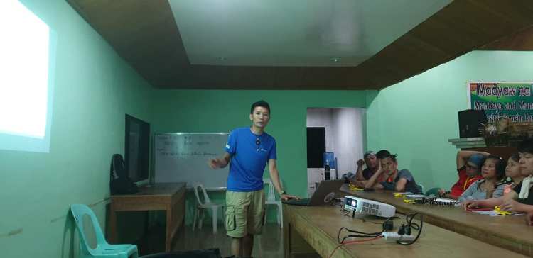
Then we were each called to sit on a chair behind the partition for the orientation. Before it started, we were given our ID and a personalized brochure. From the brochure, I learned that we were the fourth group to climb Mt. Pandadagsaan after it was featured in a nightly tv magazine show. When we opened the brochure, we were all looking at each other because the IT says, we will leave the jump off at 7 am the following morning and by 2 pm, we should be at Camp 1. Then the following day, we will leave Camp 1 at 7am and we should be at Camp 2 at 3pm. On the third day, we will leave camp 2 at 7am again and by around 4pm, we should all be back to civilization. Not bad for a 6/9 mountain rating. We had a lot of time to socialize in the camps.
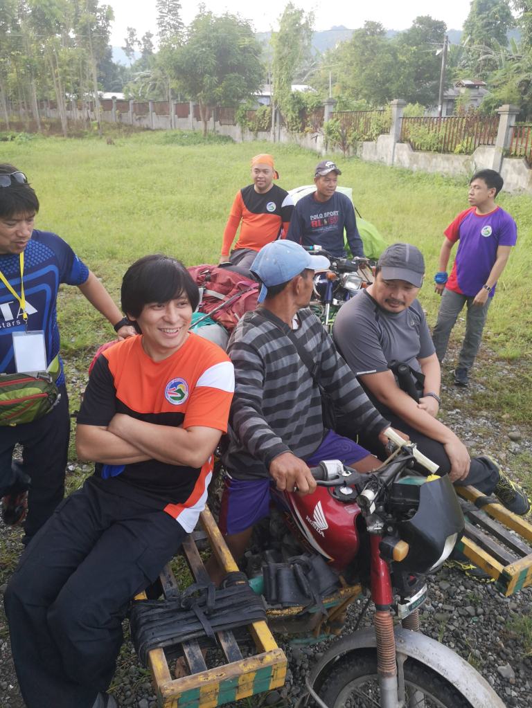
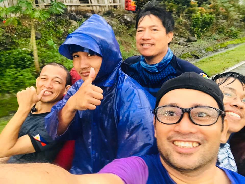
The following day, we woke up early, ate our breakfast and rode a single motorcycle with a wooden extension on both sides to accommodate 2 more people on each side. They call it skylab. According to Karis in her fb post, it “takes its name from the ’70s space station it resembles.”

After about 15-20 minute ride, we arrived at the jump off by the highway. Waited for our companions, our guides, and porters. We also weighed our group bags for porters. The maximum weight was 15 kg. Each kilo in excess of 15 would cost us P50 per day. We were able to negotiate it to P30 per day per kilo. Our group (consisting of Lea Tuazon, Mau Romarate, Jess Mar Pontillas, and Zaldy Santos) bag for porter was over by 7 kilos. We also weighed our bag. Mine was 13 kg. Lea was 16.
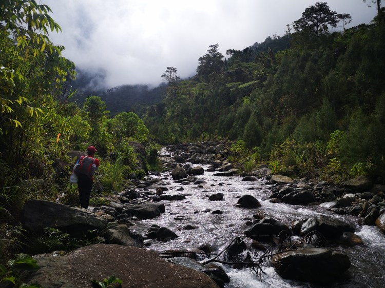
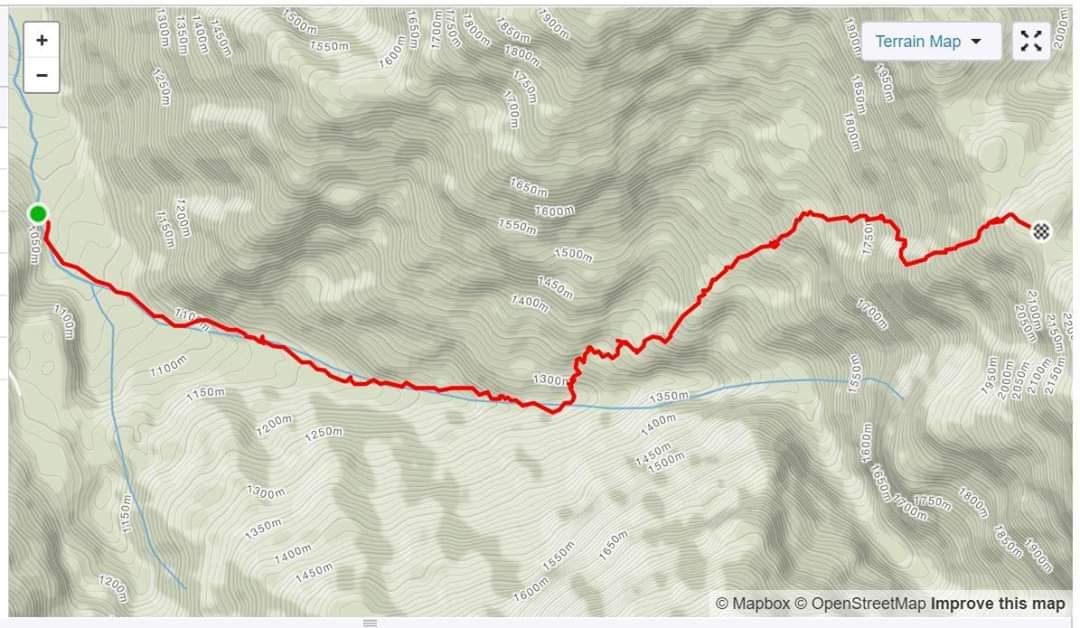
When everything was set and done, we started trekking from the highway deep into the forest, cross a wooden bridge to the other side of the river and for the next two hours, we were following the course of the river. I was on the lead with Beberlee Bugsad aka Babe as our lead guide. We stopped by the river to rest because according to Babe, we will be assaulting the mountain from there. Then arrived Long, Tonie, Mau, Jess and a few others.
After we were done resting in the river, we started trekking up and away from the river and all hell broke loose. Whoever rated that mountain as 6/9 must have been guessing or have not actually climbed it.
We were to rappel through 6 ropes, said Babe. I told Babe we would eat lunch after we finish the 6th rope. He was ok with it. But I was not. After the third rope, I remembered feeling my leg muscles softening and my arm muscles dessipating in strength as I grew hungry. I remembered our two day IT in Mt. Guiting-guiting in Romblon when on the last day, my knees could no longer bear the weight of my body I was so scared I was going to be rescued. It was a good thing, Aldrin had almonds, and wafers. After I ate them and rested for a while, my strength went back. I promised myself, it will never happen again to me in the mountains. So, when I started feeling weak, it was a symptom of lack of food. We ate lunch.
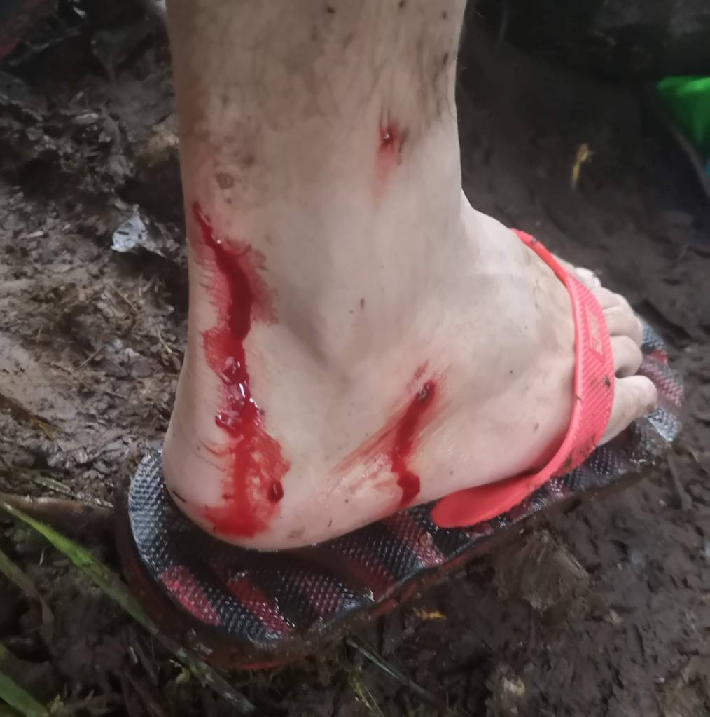
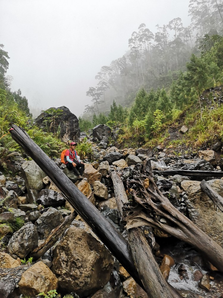
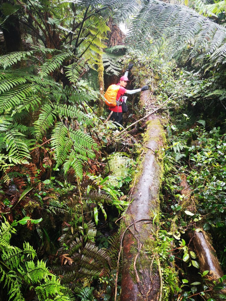
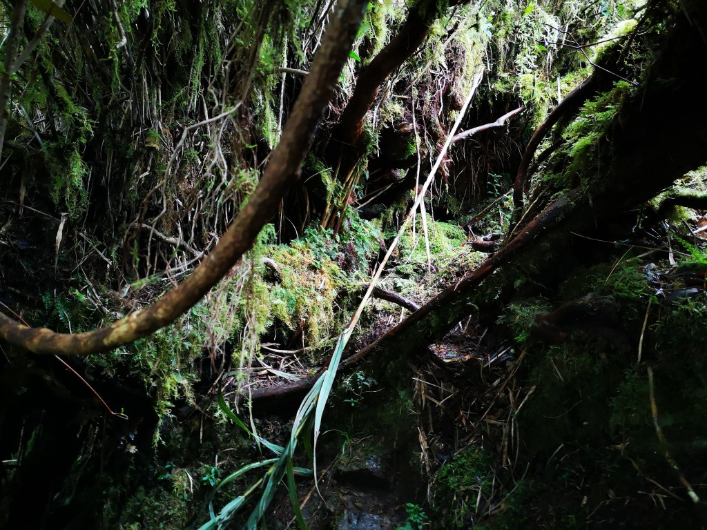
By 2:20 pm we were on Camp 1. But the last from our group arrived there at 6 pm. All wet and exhausted. Why did we ever underestimate this mountain, we said to ourselves. Ah, it’s because of that famous mountaineering blog that rated this mountain 6/9. No doubt the rain made it more difficult. Even then, the trail was too technical, there were portions where there were nothing to hold on to on both sides to carry yourself up, and the height or distance from the ground to the next level made it more difficult for some of our team mates who were not blessed with extra inches of height. The mud, the slippery trail, the unending assault to the camp site for four consecutive hours. I counted only two level grounds to walk on after the river and before the four hour assault to Camp 1. We had to hang on to 6 ropes to climb the slippery portions of the mountain. My hands were punctured from rattan thorns or some poisonous vines because there were times I did not notice the thorns. I just held on to them on my way up and down the trail. Portions of my palms still felt numb after a few days.
So, it’s advisable to wear gloves in climbing The White Peak. I had gloves, but not for thorns but for the cold. I did not want to destroy it with the vicious thorns. Instead, I chose the wisest decision of all. Allow the thorns to puncture my palms.
In Long’s words, in his introduction when he shared this article in his FB wall, he described the trail this way:
“Yup the hardest so far. Its a 1,900 meter vertical climb to camp 1 (jump off at 160 masl, camp 1 at 2,000 and summit at 2,600).
“It has all the challenge you can think of- river trekking, vertical walls, cliffs, knife edge, loose rocks, loose soil, root trails, muds, landslides, trees to go over or under (what I call senior non-friendly trail), slippery logs to walk over ala American Ninja Challenge, rattans and palms we call teka-teka (when you get caught off its barb wire like protrude, all you can utter will be teka! teka !!)- and in the brink of slipping, that is the only hold available so you have to assess your pain priorities quickly, vines on the trail floor whose intent is to trip you, limatiks up to the campsite (sorry limatik, you are not the star of this climb as there are other pressing matters to attend to), limited water source at higher level, cold temperature and rains. The mud was my deal breaker- it really made me feel miserable. I feel like a carabao ploughing the field. I never thought there is still a trail out there that would put me near the verge of crying. Until this. I remember near camp 1. I was already frustrated after that feeling that I should have already been in camp 1 hours ago. Tired, sore, aching and hungry, then I slipped on the mud and lying on the floor, I was in the verge of tears but I opted for the more manly alternative. I shouted ‘Putang Ina!’
“The lack of information also didnt helped as well as the time estimates they used based on fastest trekkers than average. I actually concluded that even if you physically trained for it, it will help but will not ease the suffering. I had a big slip that split my legs with one of my foot touched my head. Imagine climbing a vertical wall of mud !!! And wait when you descend it!! They should have just created a mudslide. It will really help if future climbers would have a picture of such scenarios. I was joking that besides putting the snow boots on your trekking pole, crampons would help.”
In the end, our TL made a wise decision. We were going to camp in camp 1 for the next two nights. The following day, we were going to day hike until peak 2 and the Avatar Forest. While he, and some of our team mates went down on the second day. Judging by their experience on the first day hike, they decided they could no longer continue. When we asked our guides about the nature of the trail from Camp 1 to Peak 1 & 2 and Camp 2, they said it was no different.
The following day, only 8 of us continued to Peak 2 and to the Avatar Forest while 7 of us went back down to the Tribal House where we were hosted for a night after our orientation and prior to our climb.
The 7 thought about our second mountain, Mt. Hamiguitan. If they go all out in Mt. Pandadagsaan, they may not be able to climb Mt. Hamiguitan. And based on the speed of our group, someone has to make sure that some of us arrive early on the foot of Mt. Hamiguitan to check on our accommodation and our climb requirements.

In Camp 1, Ryan Belayo, one of the owners of that ancestral domain mountain, who swept and conducted the orientation on us, was joking. This is just a 6/9 mountain, why did you find it that difficult? The campsite was muddy, I did not anymore wore my slippers in the camp on the second day since it got stock in the mud and did not serve its purpose of making our feet mudfree. And the blood sucking limatik were everywhere even inside our tent.

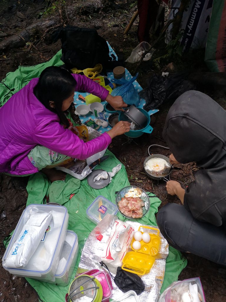
The porters and guides had a tarpaulin hanging in the middle of the muddy camp site and they had another extra tarpaulin which they used to sleep on and surround themselves with to protect them from the rain and the cold.
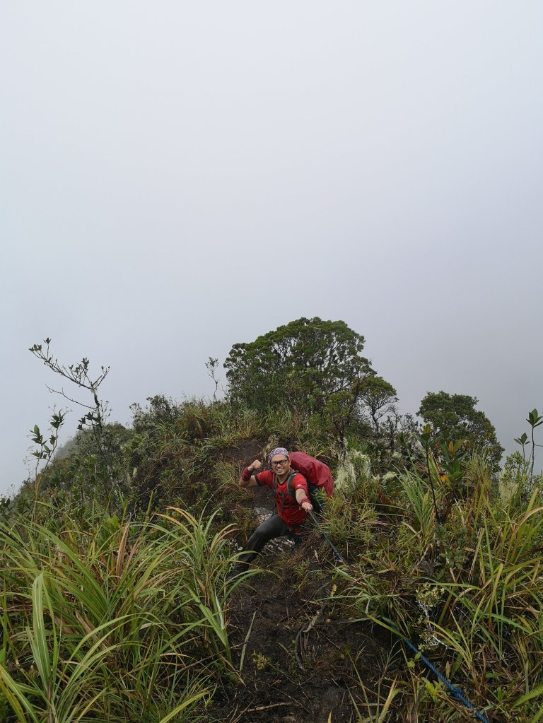
The following day, 8 of us went with only our packed lunch, trail food and water and proceeded to Peak 2 and to the Avatar Forest.
On our way to peak 1, earthquake struck. Roy, our outgoing president was so scared it might divide the mountain and some of us who were on the lead might be separated. He shouted that we regroup. But we on the lead didn’t feel the earthquake at all. So, we wondered what was the regrouping for. Still we waited for them in a mossy forested area, took some pictures until they arrived. It was there we learned that there was an earthquake.
It was already raining. Not hard but consistent. In Mt Tabayok in Benguet, I learned a hard lesson there: never get wet. I had a jacket but not water proof. So, I was wet. The only good thing in Mt. Tabayok, it was only around 3 hour trek from our house. I left them in the summit to regroup in Mt. Tabayok and I started descending the mountain to prevent the onset of hypothermia. So, in the White Peak, I was ready with my water proof jacket.
Just over and below Peak 2 is the campsite of the guides and porters. But unlike in Camp 1, there was no tarpaulin hanging in the camp. We had to hang it ourselves. Roy took my trek poles, tied one end to another and used them to prevent the tarpaulin from sagging in the middle.
The avatar forest is about 10 minutes away. But it was raining hard now and some of our team members didn’t have extra clothes or jacket so, we couldn’t proceed to the avatar forest. Our porters and guides served us coffee and they lent us their extra tarpaulin so that Jess and Lea, Mary Glazel and Stanley can wrap themselves with. When the rain stopped, we pushed to the Avatar forest.
After about a hundred pictures, we went back to Camp 2 to get our things and hurried back to the Peak 2 for a group photo. Then went back to camp 1. By 6:30 pm, we were back in camp 1. It was so dark you would think it was 8 pm.

Day 2 notes: On our way to Peak 2, Mau, our outgoing vice President’s left shoulder was dislocated but Stanley our Davao native host and PT put Mau’s shoulder back. Lea was so wet and cold Ryan lent her his shirt, looked for our porter and took her waterproof jacket. She felt so cold and she was not feeling well dispite the coffee and the jacket in Camp 2 she was having second thoughts in joining us to the Avatar Forest. Besides, her knees were aching since yesterday’s climb perhaps worsened by the 16 kg bag she was carrying. Eventually, she joined us. But since she wasn’t feeling well, she refused to have a solo picture by the Avatar Forest. She just stood by the side her face almost covered by the hood of her jacket and watched us have multiple pictures. But she did took a group selfie.
On our way back to Camp 1, I could no longer catch up with the speed of Jess, Mau, and our lead guide Babe. Stanley was behind me. He refused to advance. He said he needs a company when it got dark.
When we were nearing camp 1, Mau slid in a ravine. When he could not bring himself up, he shouted for help. Babe went back to save him as Jess continued to the campsite. Even veteran climbers sometimes forget that a headlamp should always be on your head or neck if not in your bag and not in the porter. That is what happened to Mau.
In the end, we commend the presence of mind and the knowledge and expertise of our porters and guides. Imagine, they remembered to bring a cookset, a stove and coffee to Camp 2. It definitely saved some of us from hypothermia.
Then, we realized, as correctly observed by Long, the IT they printed on our brochure was based on the fastest to arrive at each stop not the average speed or time. Our guides and porters have our names and check each person and write down the time of arrival in each stop.

On the final day, we left Camp 1 at around 9:30 am. Before we began our descent, Roy called us up for a group meet. He began by saying since we had team mates who were no longer in top shape to go down the mountain, he asked that those on the lead should walk slowly this time because we were short of people to rescue anyone in case there was an emergency. If our distance is not that great, it would be easier to call on the people at the front to go back and help rescue the people at the back.
It was now impossible for Lea to carry her backpack unless we want to break her knees. So, Ryan assigned Babe to carry Lea’s back pack while she carried Rogie’s around 6kg backpack, and Rogie carried Babe’s heavier pack. Antonio Lapiz aka Baka had to leave ahead of us to ask for backup from the guides and porters that went down the day before.
I wanted to be careful on our descent. The memory of our Mantalingajan climb where I bumped my right knee on a stone on the way down from Manta’s summit caused my right knee to swell. And then, after about an hour, I fell on the trail. It took one week before the pain went away and a visit to Orthopedic Center to make sure my right leg bones were intact.
Even though I was careful, I still could not get away slipping on the trail. It was good I had my back pack to protect my back from the impact. I thought about writing something to encourage hikers to wear backpack because it’s not only a pack per se. It protects us from back injuries.
Babe pointed out the place where we had lunch two days ago and we were only about 30 minutes in our descent. He was confident we could be at the jump off by 3pm.

We were trekking very slowly that perhaps, Babe became bored. He shared that he was the son of a pastor father and a preacher mother of a Penticostal church. That he attended a three day seminar workshop to train as Mt. Pandadagsaan guide. He doesn’t climb or serve as guide if it will take away his Sundays since he practices worship songs and other things with his parents. He is married to a public school teacher with two children.
He also asked me questions like how many cases I have handled. How many cases I have won. What were the cases I handled. What was my wife’s job. Where we met, and other personal questions I was happy to answer for him.
I was getting hungry but Babe said the Chocolate River was near. Its called chocolate because although the water looks like chocolate as it runs in the river, its potable. The chocolate color only comes from the color of the soil but the water was transparent. I wanted to reach the river and have lunch there. Since, I was getting weaker, there were more slips and saved by the bag moments.
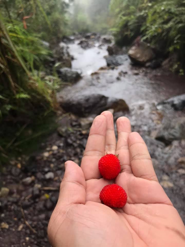
We had lunch at the river. After awhile, Mau arrived. The first thing Mau did was wash his shoes and socks. I watched him as I carefully ate my lunch. Babe forgot to take out from his bag that was carried by Rogie his packed lunch. He had with him biscuits, cookies and water. I was too tired and hungry to offer him anything. After washing his clothes, Mau started eating while I was done with lunch. When I saw that Mau had so much adobo, bacon, and rice in his packed lunch, I told him Babe had nothing for lunch. Babe denied this as he said he had biscuits and cookies. Nevertheless, Mau offered him a string of bacon which he took and ate. After eating my lunch, it was now my turn to wash my pants, socks, and shoes. Then the back up guides called by Antonio arrived. After I was done, I picked wild strawberries by the side of the river as Jess and Stanley also arrived and ate their lunch.

Mau and I continued trekking down with Babe. We left the guides, Jess and Stanley who said they would follow after they were done. What seemed a short walk by the river two days ago seemed forever to accomplish now. After a few minutes, I heard the sound of Jess’s trek pole from behind me. By this time I could no longer see Mau. I realized on our way to Peak 2 that he was an inch taller than I was and his strides were wider. I now understood why I always had to run to catch up with him on the trail. But this time, I didn’t have the energy to uan and catch up with Mau. I just wish he didn’t get lost as the trail signs sometimes disappeared and Babe was leading and guiding me all the way like he was my personal guide. When we were nearing the bridge, I asked Jess where was Stanley. He said Stanley was just behind him. When I arrived in the highway, Antonio Lapiz aka Baka was there with a smiling face congratulating us and ready to serve us coffee. He wrote my time of arrival at the end of my name on his list: 3:35 pm together with Jess. And then Stanley few minutes later. Mau arrived 10 minutes ahead of us despite his dislocated shoulder.
We refused Antonio’s coffee and off we went to the Tribal house riding skylab again and prepared to travel for 4 hours by van to Davao Oriental to climb our final mountain, the UNESCO World Heritage Site and Park Mt. Hamiguitan.
Here is Long’s technical data and analysis:
“2.2 KM River Trekking
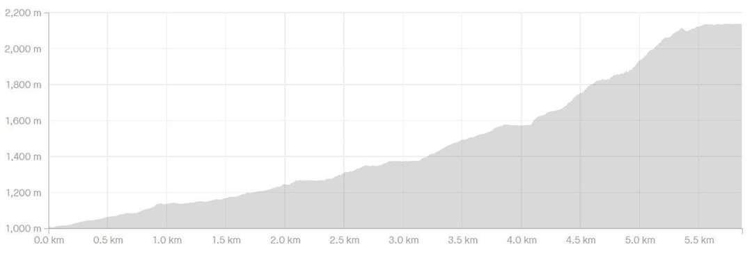
“Total distance to Camp 1 – 5.86 KM (since I started recording from bridge so mga plus 200 to 500 meters iyong bridge from road (jump-off) so ang total nasa 6 to 6.3 KM)
“Correction dun sa altitude – jump off is around 900-1000 MASL. Camp 1 is 2,130 MASL so ang total gain sa day 1 is 1,000 to 1,300 meters.
So ang altitude gain is similar to Makiling, pero short lang ang trail at 6KM so mataas ang gradient or angle of slope. Kung titignan nga parang madali kasi maiksi lang- ang nagpahirap talaga yung mga obstacles (lalo na yung Potek na putik) saka yung steepness that require the use of upper body saka large strides or step ups.”
Finally, here’s the 20 minute video of that climb:
White Peak Contact –
Lynne Mangubat Dollolasa (FB)
0950-2687624
Van Contact – 09268283856

Pingback: In Davao with Macario Tiu and Karlo David | Pilar, Capiz
Pingback: UNESCO Heritage Site and Park Mt. Hamiguitan | Pilar, Capiz